Indian Cave of Alder CreekSespe Wilderness Area of Los Padres National Forest
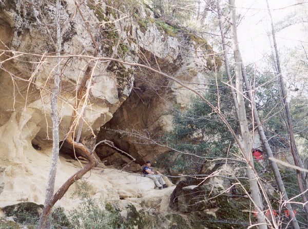
Highlights: The hike to Indian Cave is a strenuous 17-mile backpack (roundtrip distance) that vists a sandstone cave with Chumash Indian pictographs in a remote wilderness setting.
Directions: The drive takes about two hours from Bakersfield. Head south on I-5 over Tejon Pass. Just before Magic Mountain, take Route 126 towards Ventura. In Fillmore, turn right on Main Street and follow it north for about 5 miles to a dirt road which heads off to the right into the Sespe oil fields. Follow this dirt road, which winds spectacularly along several gorges, for 10 miles to a locked gate at the Dough Flat Condor Lookout. Trailhead: The hike begins at Dough Flat (2840 ft) and follows the trail to McDonald Cabin. A trail junction is reached after 2˝ miles of up and down walking, take the left fork. A half mile of level terrain then leads to the Cow Spring campsite (3500 ft). The trail then drops steeply (1,000 ft of elevation loss) to a gorge where a signed trail junction (2800 ft) is reached at 6 miles. Bushwack a short distance down the path on the right (north) that leads to the head of a gorge. DO NOT GO UP THE GORGE, as it contains dangerous cliffs. Instead take a path on the right (east) that switchbacks over a small but steep hill. The trail then drops to a dry creek crossing, skirts the head of the aforementioned gorge, and follows grassy gullies to another small but steep hill to the northwest. The path through this stretch is hard to follow, and map and compass are strongly recommended. From the hilltop, a good trail drops to Alder Creek at 7 miles, but deteriorates rapidly as it heads upstream, crossing and recrossing the creek. The Indian Cave campsite (2990 ft) is reached when the gorge opens out at a flat area with a large oak tree at 7˝ miles. The cave sits 20 feet above the creek, a few yards downstream from the campsite. Maps: The 7˝-minute topographic quadrangle is Devils Heart Peak Peak. Cautions:
More Attractions:
|